Blog posts tagged maps
Map updates, December 2025 - Now with more PMTiles
In addition to 2025, we’ve also added new imagery from 1920, 1936 and 1961 all produced using the Allmaps Editor to georeference existing collections materials. I’ll talk more about some of the tools and workflows we’ve developed to work with Allmaps in a future blog post. All of these new maps have also been added to the interactive map application on display in the Terminal 2 SkyTerrace Observation Deck. As part of those updates we’ve also started serving these historic maps from PMTiles databases rather than folders full of individual tiles on disk.
This is a blog post by aaron cope. It was published on December 15, 2025 and tagged maps, protomaps, ios, swift and vapor.
Small focused tools for visualizing geographic data

This is a blog post about a series of small, purpose-fit web applications that can be run from your local desktop (or a remote server, if necessary) to visualize geographic data in a map. The first application lets you visualize GeoJSON files, the second SQLite databases containing MBTiles data and the third GeoParquet files. These are tools which were written to address specific use cases for SFO Museum but are sufficiently generalized, even though they each only try to do one thing well, that we are sharing them in the spirit of generosity.
This is a blog post by aaron cope. It was published on October 02, 2024 and tagged maps, geo, geojson, mbtiles, geoparquet and golang.
Presenting the SkyTerrace Interactive Map at NACIS 2022

The good news is that, when the airport and the museum began to resume on-site operations in earnest, the application I’d developed had been running unattended and attached to a big honking monitor for 18 months and everything still worked. The bad news was that no one wanted to touch any kind of public surface anymore.
This is a blog post by aaron cope. It was published on October 28, 2022 and tagged skyterrace, nacis, maps and ios.
Map updates, August 2022
On a personal note I am especially excited about the 2022 aerial imagery because it appears to have captured the aircraft I call “Cake Plane” visiting SFO.
This is a blog post by aaron cope. It was published on August 08, 2022 and tagged maps.
Serving map tiles to yourself using Protomaps and iOS

Aside from solving an immediate technical problem we are excited about how this approach might be applied to future projects and we hope you will be too.
This is a blog post by aaron cope. It was published on March 30, 2022 and tagged swift, ios, maps, protomaps, openstreemaps and skyterrace.
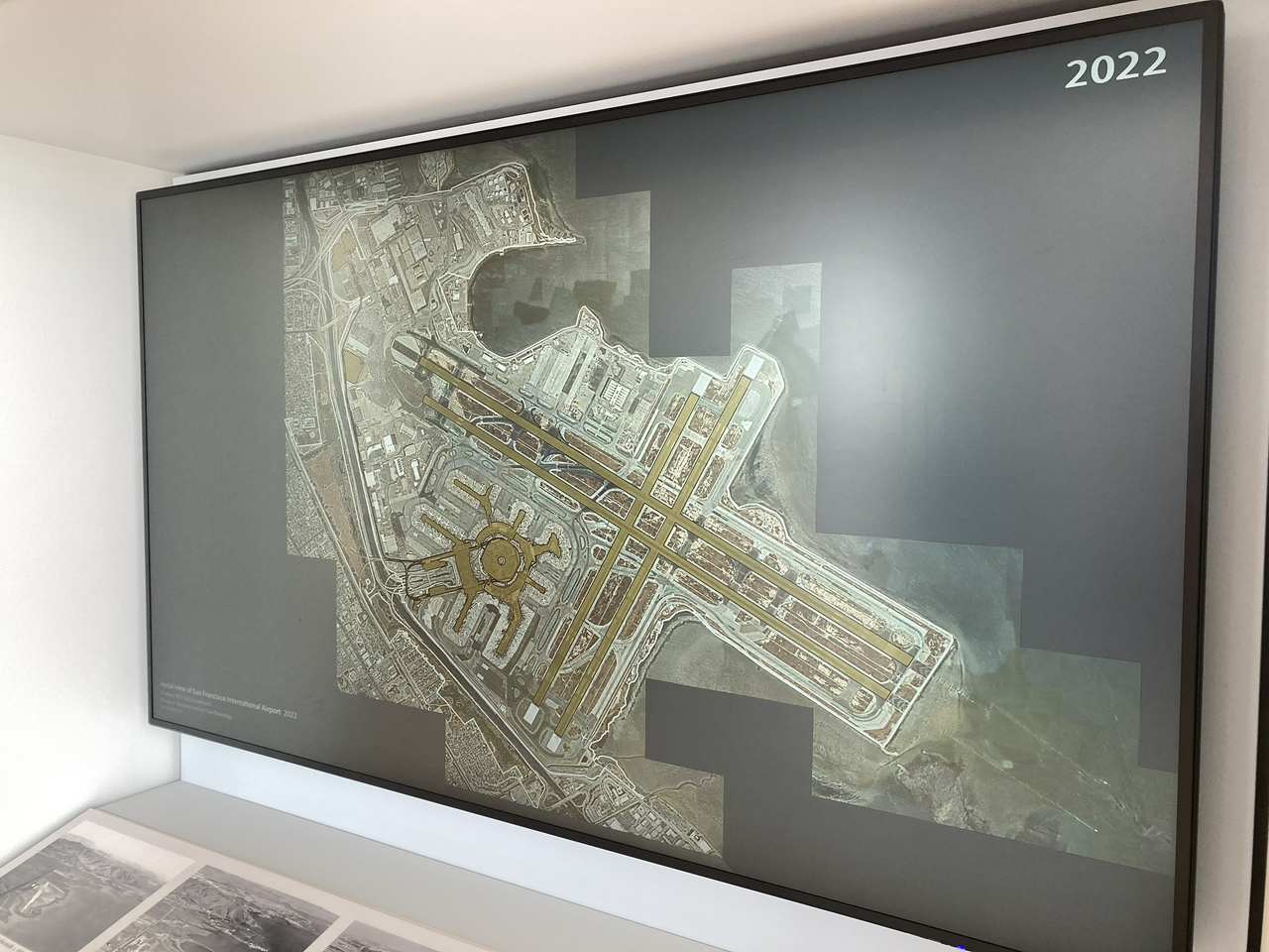
Interactive maps of SFO from 1930 to 2021 (and beyond) at the T2 SkyTerrace
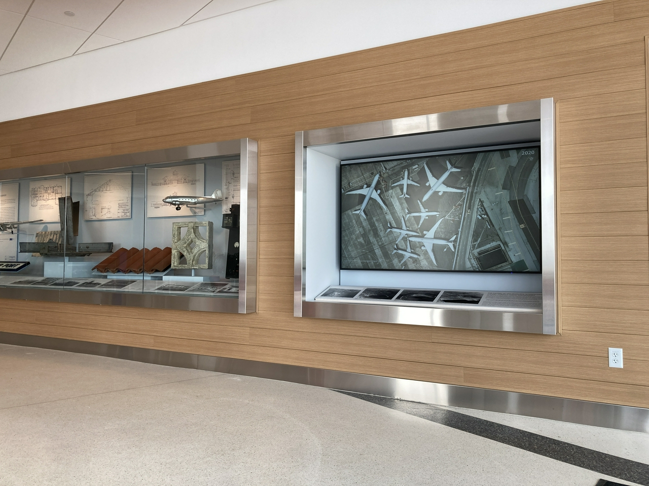
The recently opened Mills Field and the San Francisco Airport exhibition in the SkyTerrace observation deck in Terminal 2 includes an interactive map installation that allows visitors to view the history of SFO by browsing over three dozen aerial maps from 1930 to 2021. Orginally designed as a touch-based interactive application, designed to work entirely offline, it was updated earlier this year to allow visitors to control the map using their personal mobile devices.
This is a blog post by aaron cope. It was published on November 19, 2021 and tagged maps and skyterrace.
Geotagging at SFO Museum: Client-side EXIF, Web Components, Tilepacks, AppRunner and Live Demos

While this particular instantiation of the geotagging application is scoped to the physical boundaries of SFO the code itself is not specific to SFO Museum. It can be used, in combination with custom databases of map tiles and geographic data, with any image on your computer. This code will continue to be the common infrastructure that we build a SFO Museum application, specific to our needs, on top of.
This is a blog post by aaron cope. It was published on June 16, 2021 and tagged golang, geotagging, aws, reverse-geocoding, tilezen, maps and aws.
Geotagging at SFO Museum: Protomaps, search and reverse-geocoding

The bad news is that, when you look closely, there really are that many moving pieces when it comes to something like geotagging photos. The good news is that nearly all of those moving pieces, from the underlying data to the tools to operate on those data, are within the reach of cultural heritage as low-cost and open-source alternatives to the commercial offerings. We may still need to stitch those pieces together to meet the needs of a specific institution but at least they are within reach now.
This is a blog post by aaron cope. It was published on May 03, 2021 and tagged golang, geotagging, whosonfirst, geocoding, reverse-geocoding, placeholder and maps.
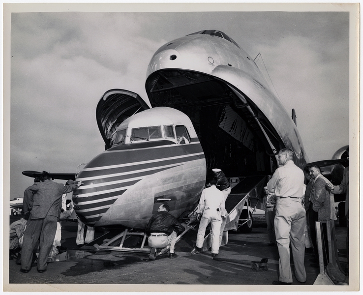
Geotagging at SFO Museum, Part 8 – Old maps
What’s become clear as we work through geotagging photos in the SFO Museum collection is that it’s very useful to be able to geotag things using a map from, or near to, the same year that a photo was taken. The facts on the ground change often and fast enough at SFO that it can be hard to make sense of an old photo using a contemporary map.
This is a blog post by aaron cope. It was published on May 04, 2020 and tagged sfo, collection, history, geotagging and maps.