Map updates, August 2022
We’ve updated all our maps to include aerial imagery captured in July, 2022. This includes all the maps on the Aviation Collection and Mills Field websites as well as the interactive installation in the Terminal 2 SkyTerrace.
This availability of this new imagery was taken as an opportunity to refactor the code used to display maps across all our websites (and the SkyTerrace). This code has grown organically over the years to the point where a bit of corraling was in order. We gathered up all the different features across all these different maps and merged them in to a set of JavaScript libraries which provide common building blocks for generating maps. These include custom libraries for handling global base map tiles, historical aerial imagery, a handy control to resize the height of a map and, importantly, a stylized representation of the SFO campus and terminal complex derived from data provided by the airport’s GIS department.
Here are a series of screenshots, all captured on August 02, 2022, to illustrate why that’s important:
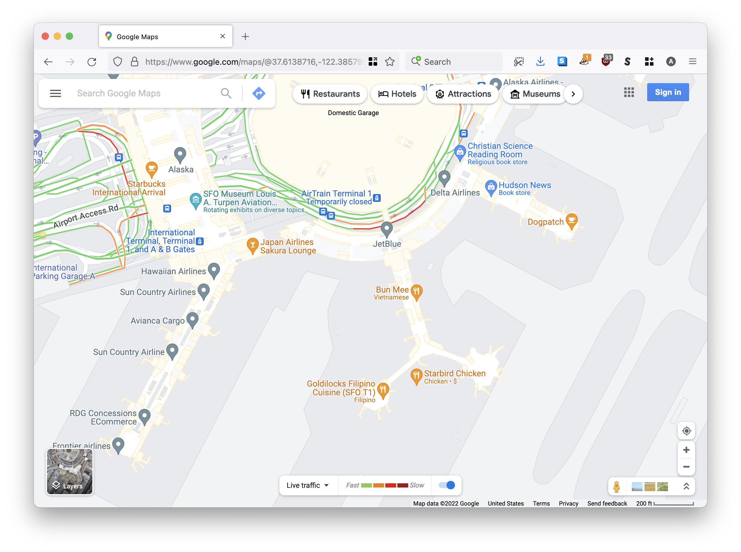
This is what Google Maps thinks SFO looks like in 2022. SFO did look like this once, but that was during the years between 2014 and 2017. Since then the old Boarding Area B with its two rotunda have been demolished and replaced by the new Harvey Milk Terminal 1 boarding area.

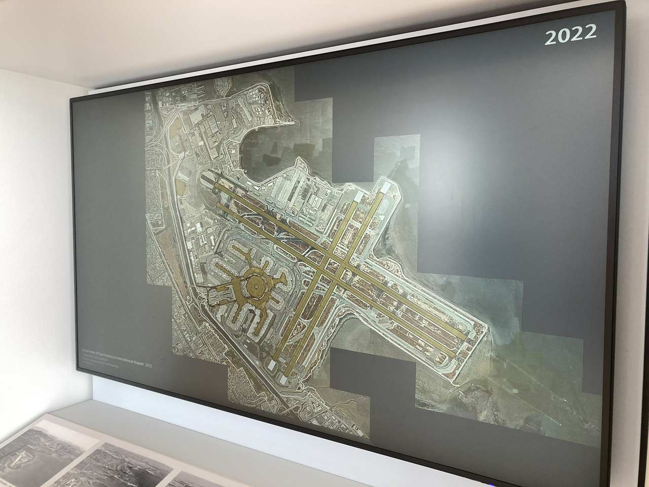
This is what the old Boarding Area B looks like overlaied on the new satellite imagery from July, 2022.

Apple Map’s understanding of SFO looks to be dated to sometime in 2019.
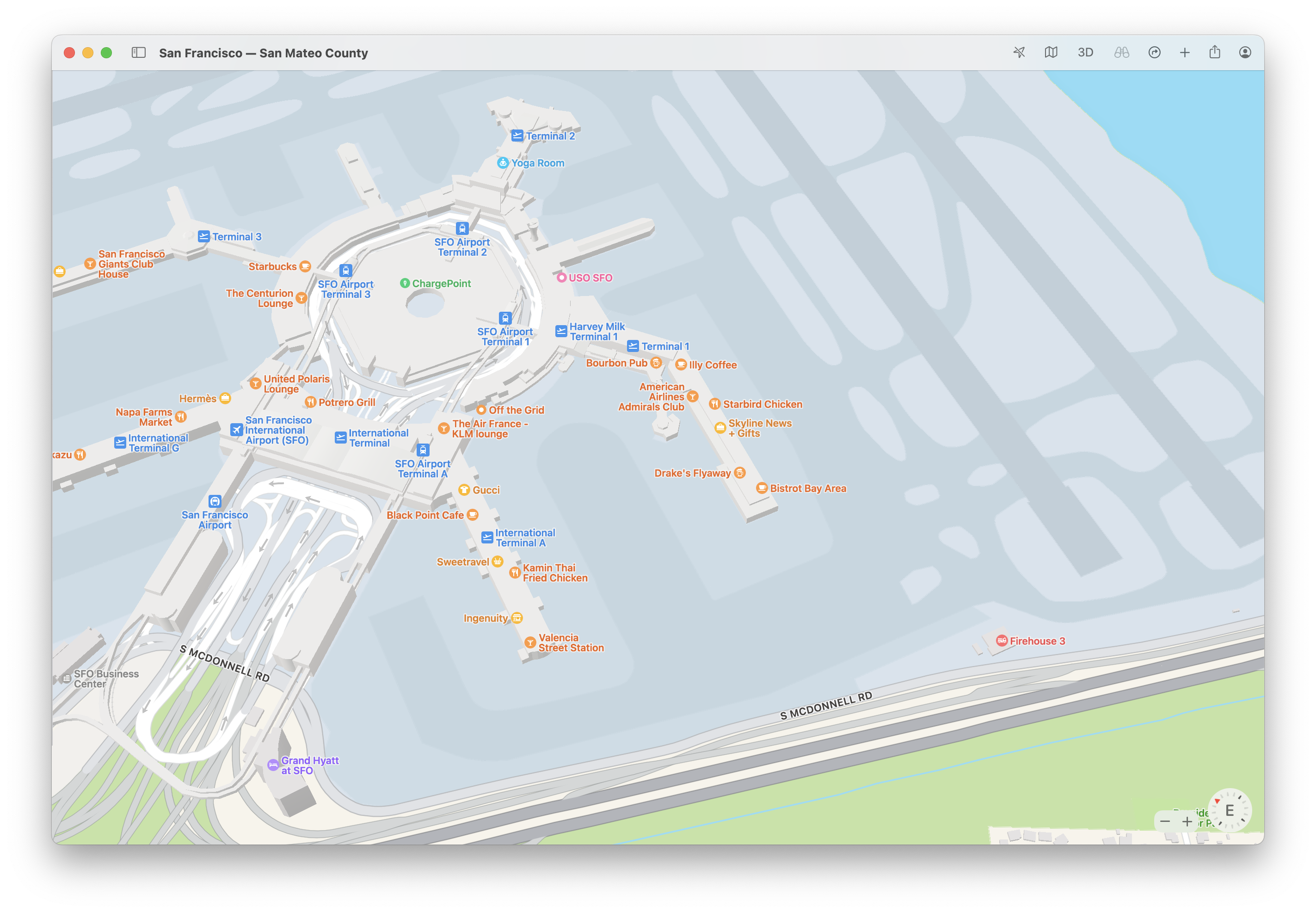
That would be around the time that the new Harvey Milk Terminal 1 building opened but before the last rotunda was demolished.

In 2022, SFO is basically parking planes in the space where that rotunda used to be.

The same is even true of map tiles produced by the Nextzen project which we’ve used extensively for our own maps. Like Apple, Nextzen thinks SFO is stuck in 2019. This is evident not just from the old architecture but also the gate numbers which were renumbered in October, 2019.

OpenStreetMap (OSM) has an up-to-date representation of SFO in 2022; however, we are not using OSM for our base maps, nor have we been able to justify the time of setting up a custom pipeline to process OSM data in to our own tiles. A cultural-heritage specific set of OSM tools and services would be incredibly valuable and useful but, like everyone else, we’re busy with other projects so it remains something to aspire to.

Even if we were to use the tiles that OSM publishes we would need a way to address the volume of interior data (shops, gates, inaccurate locations of SFO Museum installations, etc.) displayed on the map that we don’t necessarily want to include in our maps. This is also true of both Apple’s and Google’s maps.

Our solution to all of these problems is straightforward: We simply hide what other people’s base maps think about SFO by covering up that area with the footprint of the airport campus. Then we add a second layer made up of passenger-facing architectural elements, the AirTrain and the runways. As mentioned all of this data is produced by the airport itself so we can be confident that is accurate and up-to-date. This is very much a simplified representation of the airport but it is well-suited to the Museum’s need and nothing prevents us from adding more detailed information in the future if we choose to.

All of these data about SFO are available as openly licensed data in the sfomuseum-data/sfomuseum-data-architecture repository. These are the same data that we used in the interactive map application in the T2 SkyTerrace and we’ve adopted them for all our maps going forward. We’ve also updated all the maps to add the option to display historic aerial imagery if the map’s view port is within the bounds of the SFO campus.
Here is a video of the flight path on arrival for Southwest flight 2702 showing how historical aerial imagery is automatically loaded for a given map. It also highlights the new “resize” widget that is included with most maps allowing you to grow or shrink the height of the map.
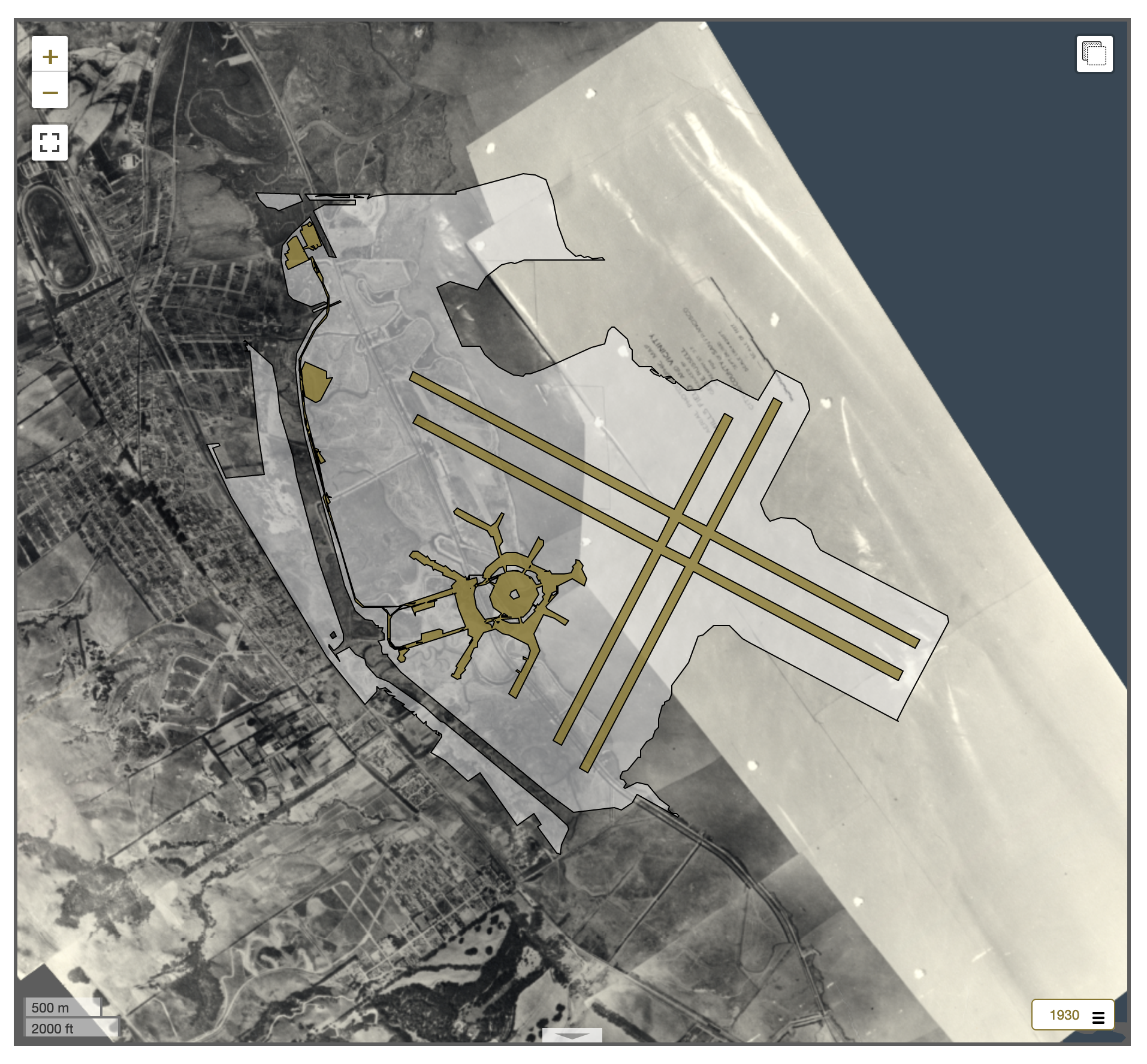
Did you notice the way the historical aerial layer defaulted to 2022? The updated map libraries will check to see if an HTML map element contains a data attribute containing a date and, if present, load the aerial layer closest to that date. For example the map associated with this photograph of the San Francisco Airport Terminal Building under construction in 1953 will automatically load the aerial imagery for the airport in 1956.
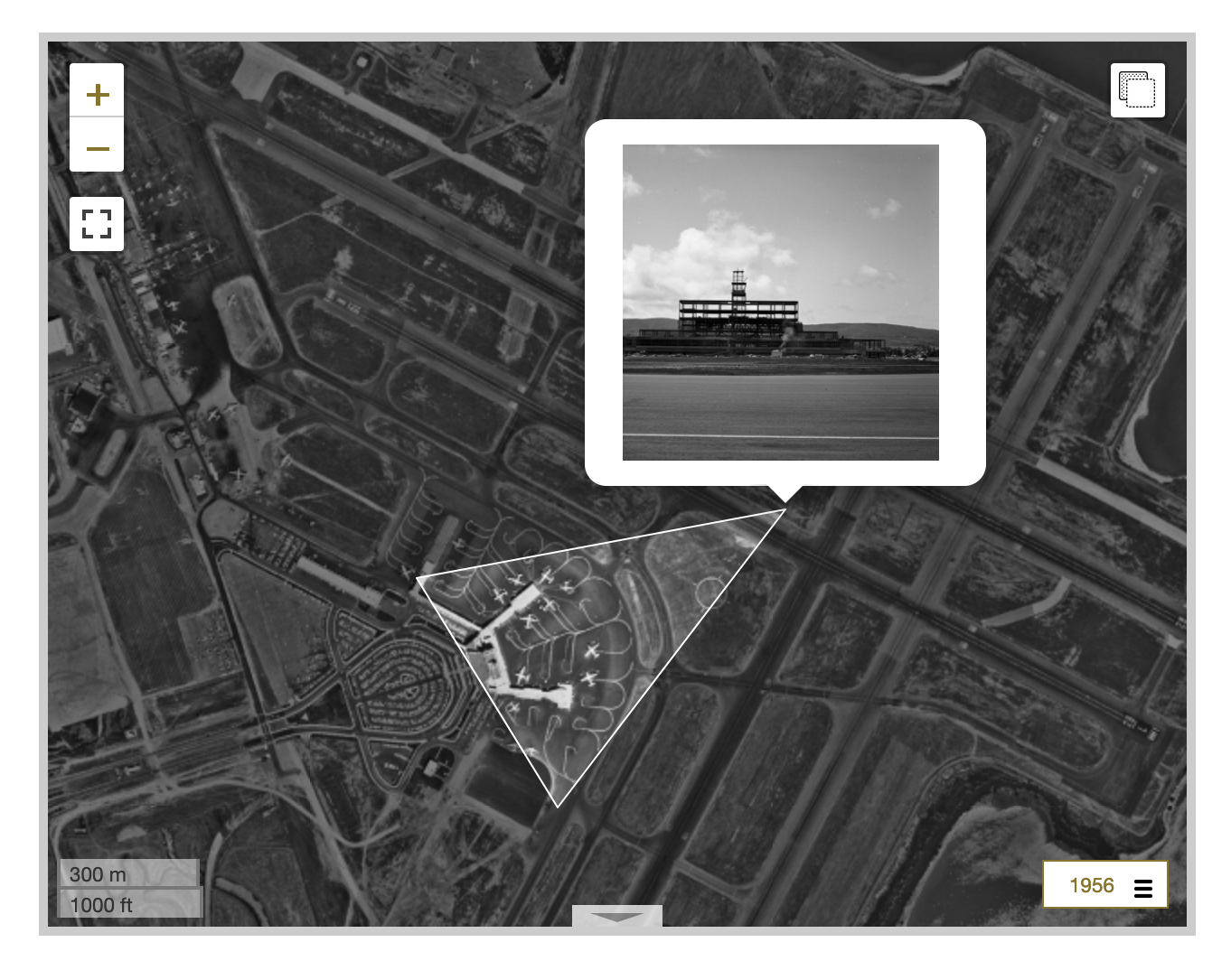
This is the same view in 2022.

We have created a dedicated project for all these new mapping libraries. It is called www-sfomuseum-map and we use it for testing different base map providers, new features and improvements before rolling out updates to things like the Mills Field or Aviation Collection websites. This project is specific to the needs of SFO Museum but we are mentioning it here in the spirit of sharing how we do things.

“Cake Plane”
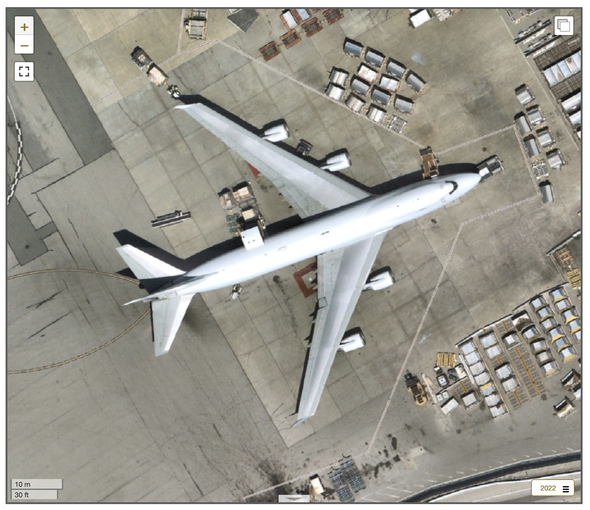
On a personal note I am especially excited about the 2022 aerial imagery because it appears to have captured the aircraft I call “Cake Plane” visiting SFO. “Cake Plane” is a 747 cargo plane, with the tail number N405KZ, operated by Air Atlas. Notably it is painted white from nose to tail which makes it stand out at an airport full of passenger airlines and their colorful liveries.
One day, a few years ago, I was waiting for the AirTrain and noticed this plane parked nearby. At the same time I caught the scent of chocolate cake wafting powerfully through the air. It stands to reason that the scent of chocolate cake was coming from the nearby kitchens preparing food for all the passenger flights departing SFO. However, I chose to imagine that all that cake was actually being baked inside the belly of this mysterious white jumbo jet; that if you opened up the nose of the plane you would be presented with a 747-sized piece of cake!
It’s not possible to see the tail number of the white 747 captured in 2022 so I am not certain whether this aircraft is actually “Cake Plane” but I like to think that it is.